Geospatial Analysis of Pittsburgh Bus Transit System
Overview Download Report
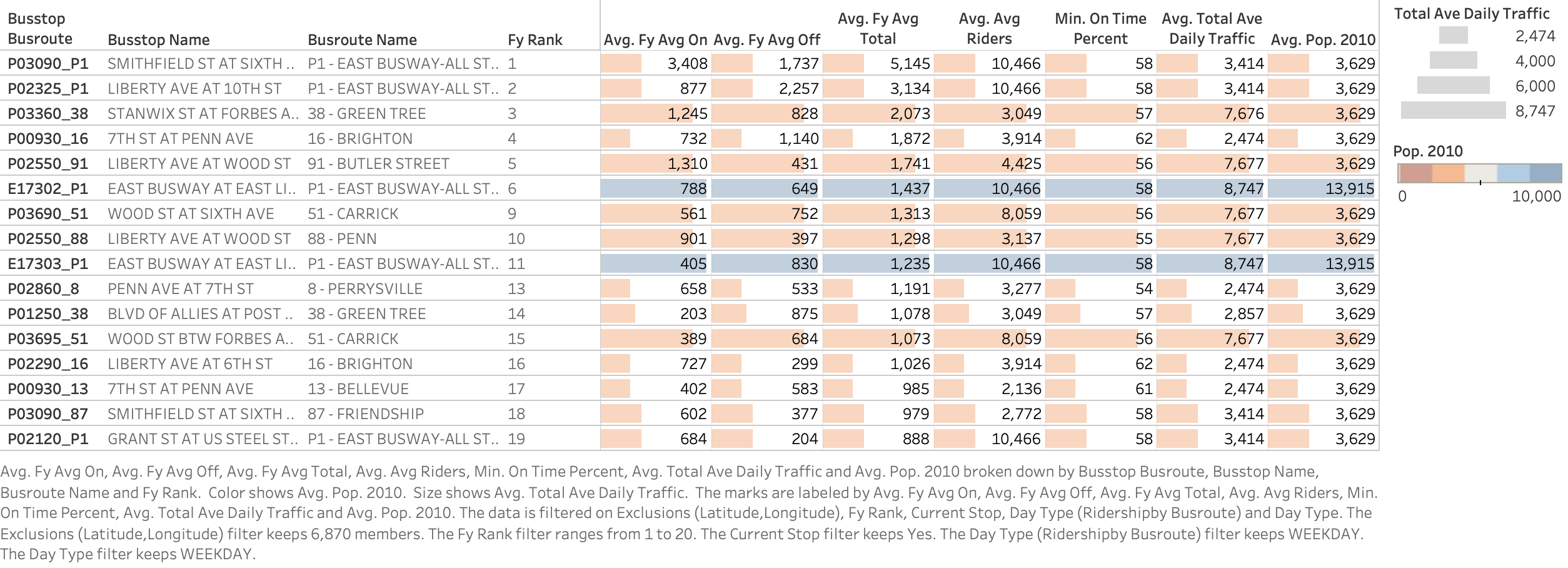
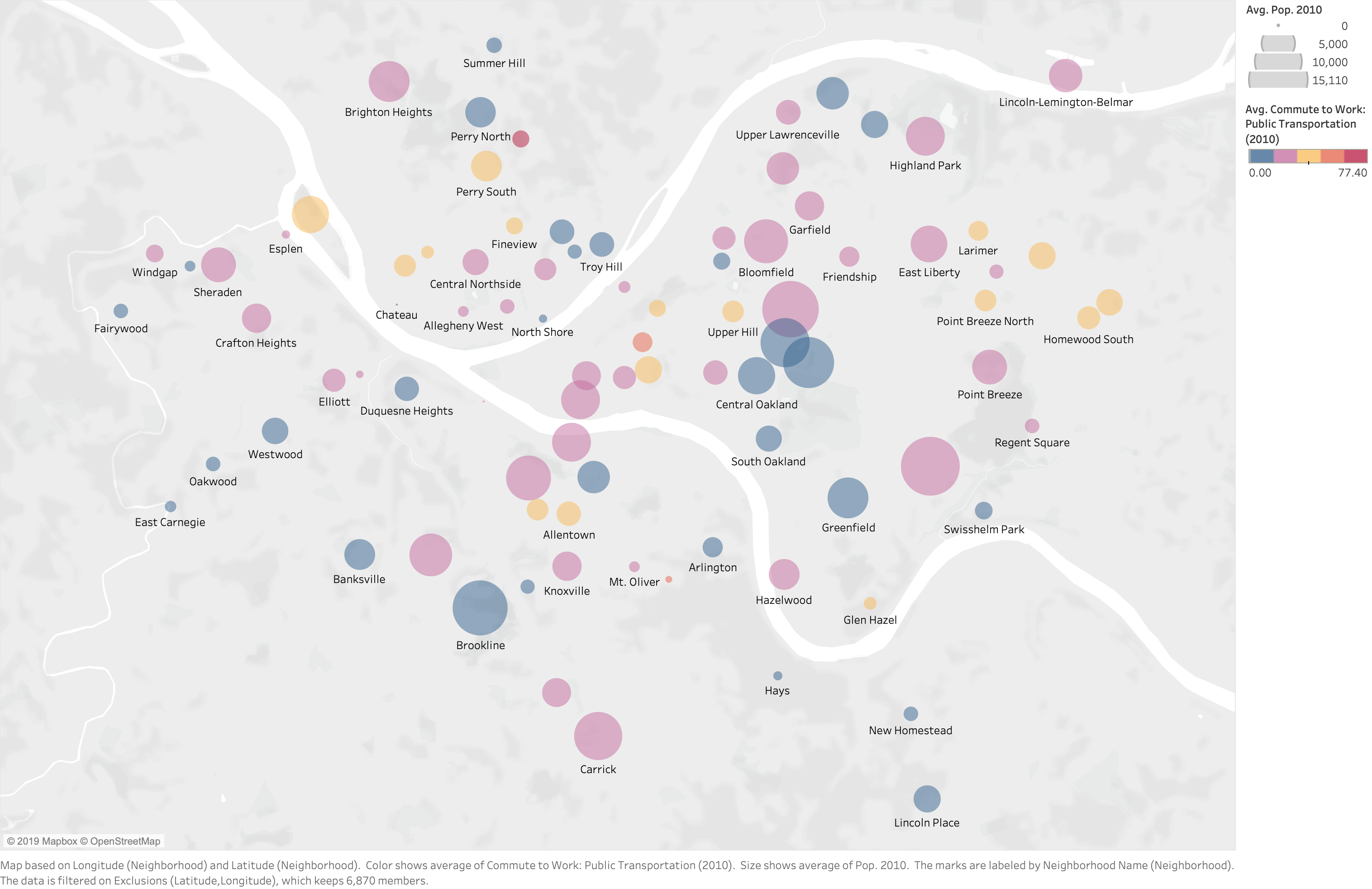
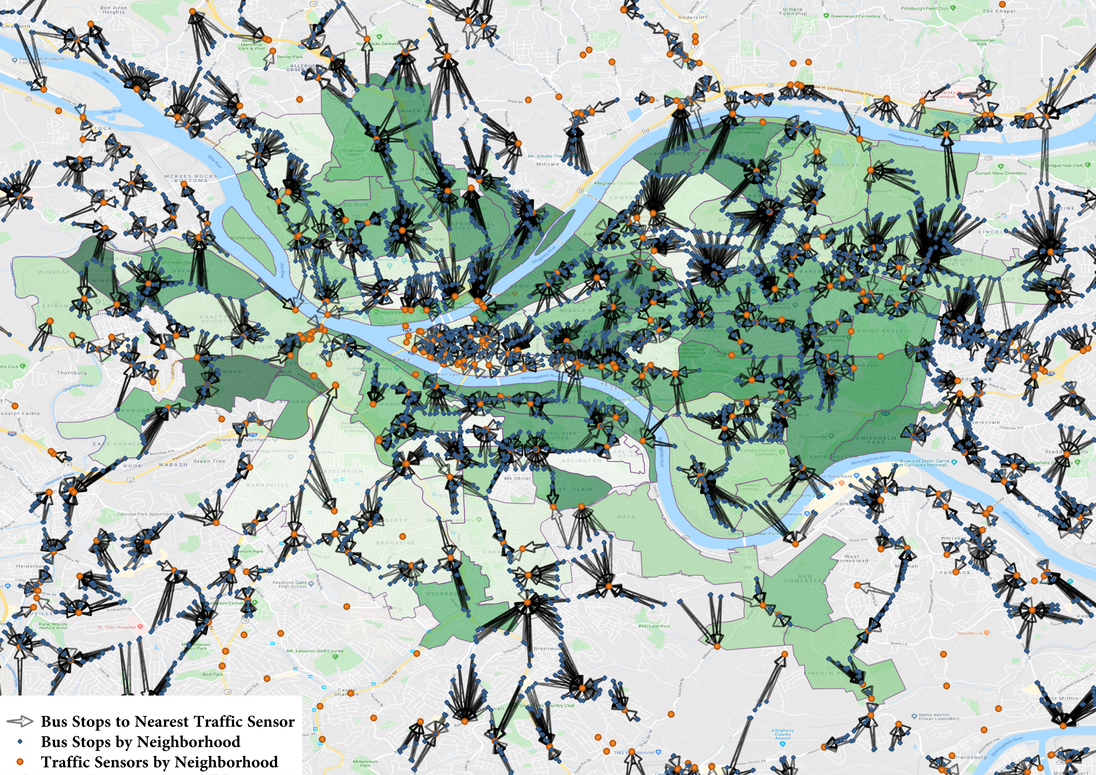
Designed a database to efficiently store disparate data and leveraged geospatial analysis in Python to create relations between neighborhoods, bus stops, and traffic sensors. Utilized SQL queries and visualized trends using Tableau to generate insights on underperforming bus stops based on given sociodemographic data and traffic count information.